|
Year - 2006
Scale - 1:31,680
Topo Lines - Yes
Plastic
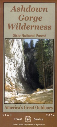
The United States Congress designated the Ashdown Gorge Wilderness in 1984 and
it now has a total of 7,043 acres. All of the wilderness is in Utah and is managed
by the Forest Service.
Sharing the western and northern borders of the Cedar Breaks National Monumnet,
Ashdown Gorge Wilderness desplays eroded, multicolored Claron limestone, meadows, and
forestland including a signifcant stand of bristlecone pine,
known as the Twisted Forest, in the northern corner. Bristlecones
are among the oldest living life-forms, and some of the trees
in this Wilderness were alive during the time of Christ. The area
is home to a diversity of wildlife that includes mule deer,
yellow-bellied marmots, chipmunks, golden-mantled ground
squirrels, voles, and mice. Creeks run year-round. Elevations
range from 8,000 feet to 10,400 feet and winter snows often
add spectacular highlights to the colorful stone formations.
|